Showing posts with label Walking. Show all posts

Saturday, 11 February 2012

Walking the Bath Beat Route

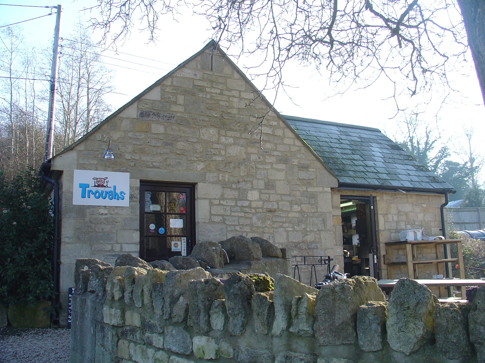
I was lazing in bed sipping a cup of tea when I had a text from my friend Yvonne asking me if I fancied going for a walk. 'Sure, when?' I texted back. 'Now.' Crikey. Ok. Forty five minutes later I was at Combe Down, lacing up my boots and pulling on my gloves. Yvonne was right though, it was a lovely day, and too good to waste.

'I've brought an OS map,' I said, mindful of previous walking disasters when we had ventured out together. 'And I've brought two headlights this time.'
'Oh, we won't need those,' Yvonne said confidently. I know this route really well, I walk it all the time.'
The route we were taking was part of the shortest route of the Bath Beat, an annual walk/running event around the Limpley Stoke valley. I decided to err on the side of caution and put them in my rucksack anyway, and we set off.

Two minutes later we were staring down the very steep path which led down the hill to the village of Monkton Combe. Very steep and very, very icy. 'Don't fancy that,' I said. Yvonne agreed. Only Alfie seemed keen, but he obediently turned around with us and trudged up to the road.We were already 'off route' and unsure where we were. Great. A chance to use my beloved map. I reached in my bag to get it.
'Oh, don't worry, I've got us pinpointed,' said Yvonne, waving her iphone4S. Sure enough a pulsating red circle was throbbing on the map on the screen. Holding it in front like a dowsing stick we traced our way down the road until we joined up with our original route.

***Warning: using a phone to navigate may be ok in Bath. But not on top of Scafall Pike. See here***

We followed the bed of the old Somerset Coal Canal to Midford. Authorised by Act of Parliament in 1794 the canal was built to carry coal from the Somersetshire coalfields up to the Kennet and Avon and thence to Bath and beyond. By the 1820's the canal was carrying over 100,000 tons per year. By the end of the century the seams were becoming worked out and the railways had taken over the freight trade. It was closed in 1898 and sold a few years later to the Great Western Railway who promptly built a railway over much of the route. There is lots of information here and here about the SCC. (The former is now the 'unoffical' website but I think it is the better one of the two.)
Partway along we found a tyre hanging from a tree and despite the fact that we have a combined age of nearly 100, the tempation was too much. We took it in turns having a swing, and then spinning eachother around until we were so giddy we fell over in the mud. It was great fun.

Eventually we dragged ourselves away and soon reached the main road at Midford, used it to cross the brook and then turned off immediately onto Midford Lane and then plunged back across fields and woodland.


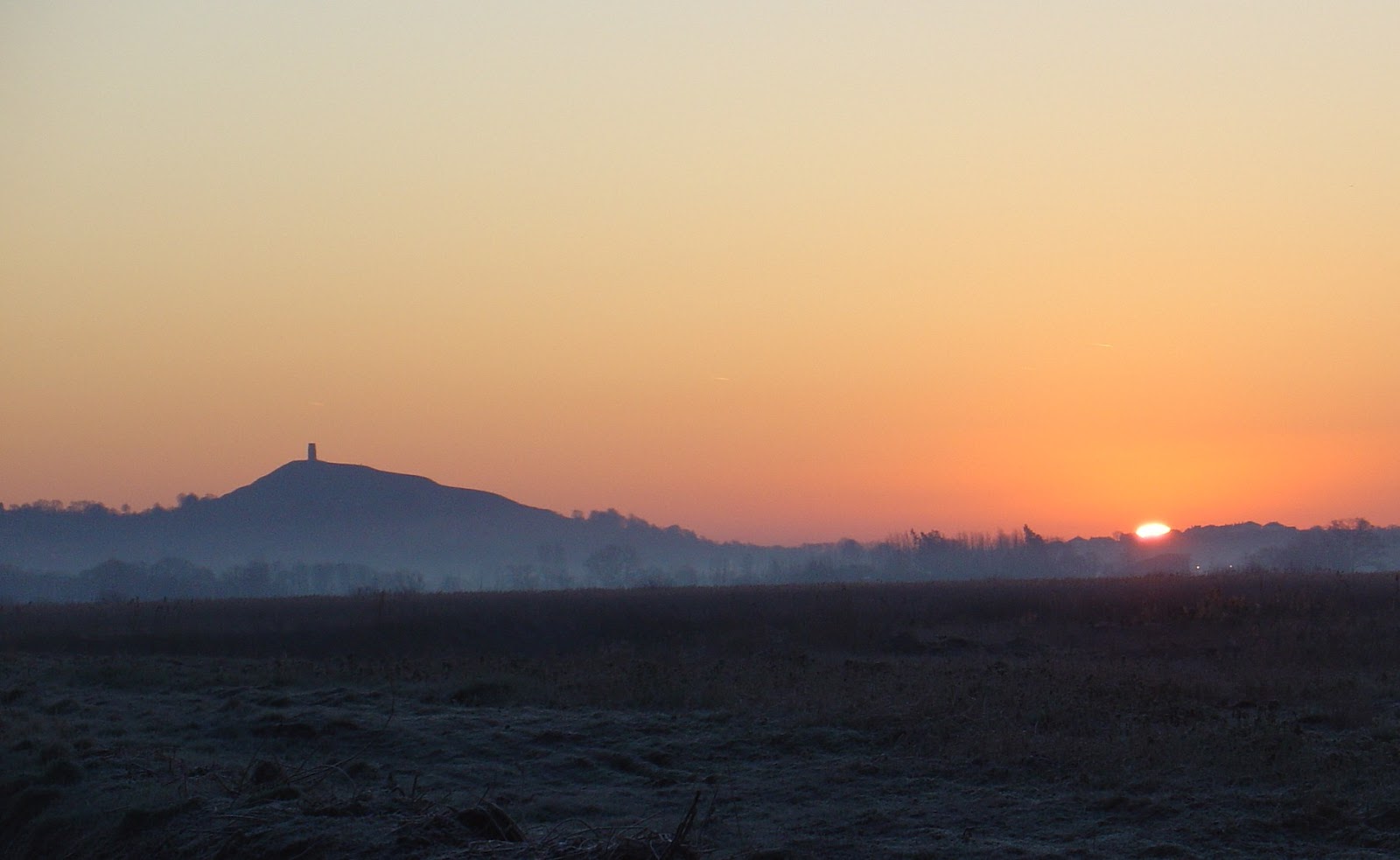
From here there was a fine view of Midford Castle, a castle folly built in 1775 for Henry Disney Roebuck. I can't find anything much about him except he was from a wealthy family and liked a bit of gambling. For decades the house was owned by writer Isabel Colegate (author of the Shooting Party) and her husband Michael Briggs. In 2007 they sold it to Nicholas Cage, who apparently was very taken with Bath and the local area. (He also bought a place in the Circus in Bath.) He sold it just two years later, apparently to help him deal with an enormous tax bill.


At Monkton Combe there is an annoying climb up the hill and then back down again to circumnavigate the playing fields and swimming pool of the
  posh Monkton Combe public school. Still, it gave us a chance to look at the old lock up dating from around 1776. Having skirted the playing fields we headed back down the hill and then turned left along the road. We were now walking the course of the old Bristol and North Somerset Railway which had superceded the canal in the nineteenth century, until the railway, in its turn, became uneconomical to run and was closed. Monkton Station, sadly now long gone, became Titfield Station for the wonderful 1953 Ealing Comedy The Titfield Thunderbolt


From derelict canals and defunct railways we headed onto a functioning canal, the Kennet and Avon. Alfie was complaining that he was hungry, Yvonne said it served him right as he hadn't eaten his breakfast, but after some truly pitiful looks from him she relented and we stopped at the Angel Cafe for some tea and biscuits. (I know, I know I said I wouldn't come here again, but hey, I never claimed to be consistent. And actually I got a smile from one of the staff today.)

The boats were pretty solidly iced in and nothing was moving. But just after crossing the Dundas aquaduct we came across a narrowboat having a go at icebreaking. It was doing a fine job of ripping all the blacking off its bow, so I assume wherever the crew was trying to get to must have been really important. Or maybe they were just a couple of dickheads, I don't know. There are a lot of them at this end of the K&A. They managed to crash the boat along for about fifty yards before coming to a complete stop in the middle of the canal.


We stood gongoozling and gawping for a while, but then Yvonne suddenly panicked, as she realised that we were short of time to get to the cafe before they stopped serving food so we left the boaters to it. We power-walked the last three miles to Avoncliffe; by the time we got there I thought I was going to throw up on the counter. but we had made it with two and a half minutes to spare and ordered some food.

After we'd eaten and I'd stopped wanting to vomit we set off across the fields to Freshford, passing through Tess's Gate.


 At least at this time of year there were no cows for us to run away from. The New Inn at Freshford looked delightful and I was very pleased when Yvonne made a bee line for it. Oh. Apparently she was just heading for the toilet. Never mind.  It's owned by the Box Steam Brewery and I made a mental note to come back soon to sample the beer. Maybe I could work it into a bike ride.

We passed Freshford Mill, a large and controversial housing development. Progress at the site seems to be at about the pace of an arthritic tortoise, it seems the developers may have gone bust. The final loop took us over the hill near Limpley Stoke. Next to one of the farms was a collection of huts and an old petrol pump, presumably a relic from World War Two.
We only had one more challenge - the very steep descent and ascent of Monkton Combe Valley. Alfie was getting weary. He kept lying down, evidently hoping one of us would relent and carry him, but we remained hard hearted. The path was slippery and we found a couple of stout sticks to aid the descent.


On reaching the car I turned to Yvonne. 'This doesn't seem right,' I said.
'What?'
'No crawling through barbed wire. No running away from cows. No staggering around in the dark. It was, as our walks go, pretty uneventful.'
'You're right,' she said. 'Maybe we're getting better at this.'
Possibly. Or maybe it was just a fluke. We'll find out next time.

Saturday, 4 February 2012

Expert Photography on the Somerset Levels

My friend Mick is a photographer. Well he's trying to be. He decided he wanted some shots of the sun rising at Glastonbury Tor and asked if I wanted to go along.
'Ok' I said blithely before realising the bleedin' obvious - in order to get a photo of sunrise we would have to get up Very Early.

'I'll swing by yours and pick you up at five am,' he said.
'F*ck off.'
'Half-five?'
'Six.'
'Six is too late.'
(Sulkily) 'Ok, half-five then.'
By some miracle I was ready to go at half-five. The temperature was minus five outside so I was fully kitted out in three layers on the bottom half and five layers top half plus hat, gloves etc. I sat and waited by the window. At five-to-six Mick's campervan rolled around the corner.
'You're late,' I said grumpily.

We headed down the A39 through Wells to Glastonbury without bothering to look at the atlas or plug in the satnav. Mick hates looking at maps, he thinks it's cheating. At Glastonbury we got lost and headed off towards Frome, at which point I insisted we pull over so I could dig out the atlas. In the end we did a massive loop around the bottom of the Levels before finally finding them hidden away on our right. By the time we had found a view of the Tor, dawn was upon us. We were on a race against time.

Mick screeched to a halt on the side of the road, grabbed his camera and tripod and legged it over a stile. Layered up as I was, I could only waddle after him like a Tellytubby. By the time I caught up with him, he was set up and snapping away.


We had just made it. Soon the orange sun appeared on the horizon, rolling up behind the green fields. I stared at it in awe - what a beautiful sight. Suddenly I had dancing spots in front of my eyes and remembered it is not a good idea to stare directly at the sun.
'My eyes, my eyes!' I cried. 'I'm blinded! Look away!'
'Don't stare at it then,' said Mick unsympathetically.
After a few moments my eyesight returned to normal and we headed back to the van to make a hot drink. 'Fancy a bit of breakfast?' said Mick.

We headed up the road to the Peat Moors centre. The centre has closed but there is a craft centre, next to which was a chuck wagon selling 'eco bites.' Eco bites apparently means no bacon and egg rolls, just falafels and flapjacks. This wasn't what we had in mind. We decided to press on with our walk and get something to eat at the pub. We were heading for The Sheppey Inn at Lower Godney which we had passed before but never been in.

We were immediately thrown by the route apparently taking us through a peat farmer's yard. Three big dogs came bounding out, barking furiously, and we were about to run away when we saw the farmer beckoning us. 'They won't hurt 'ee,' he shouted. 'come on through.' Sure enough the dogs were only curious and rather friendly. We made our way past old tractors through the barn - another example of the great British tradition that, when it comes to footpaths, 'we shall not be moved'. You can steal our pensions, trash our public transport and dismantle our health service and we won't make a sound. But don't - just don't - fuck with our footpaths.

My route took us across Meare Heath before crossing the B3151 and striking out across the fields to Lower Godney. There were some issues however. Firstly, despite the map indicating we were on a footpath there were no markers whatsoever; the rhynes(water channels) which criss crossed the fields meant we sometimes were taking massive detours; and there were no stiles, only farm type gates which wouldn't open. We had to climb each one and as they were spaced only twenty yards apart I began to feel like I was attempting a steeplechase rather than a country walk. Eventually we found ourselves at the back of someones garden and had to walk through a pigpen to get onto the lane into Godney. By this time we were both salivating at the thought of a pint. 'Maybe we could squeeze in two,' said Mick hopefully.


Fat chance. When we got there we discovered that the pub only opens in the evenings. 'Oh, that's a shame,' said Mick. (He said it a bit more forcefully than that but that was the general gist.)
'I can hear voices,' he said desperately, pressing his ear to the door. 'Bang on the door, see if they'll serve us.'
'Don't be silly,' I said.

So we trudged disconsolately back. On the way back we detoured into Meare as the OS map indicated a blue jug in the village. The path took us past the Manor Farmhouse, fourteenth century summer residence of
Manor Farmhouse, Meare
the Abbot of Glastonbury. The pub, however , was not only closed, it had been turned into a private residence. The pint of beer receded even farther into the distance. We gave up trying to find a pub and headed back to the carpark where the camper was parked.


Pub at Meare
 
Swan - Ice Breaking
Back at base we ate out of tins we had stored in the van and had another cup of tea, before donning multi-
layers once more. Mick wanted to get some photographs of Starling Murmurations. Despite the Levels being only thirty miles away, neither of us had seen them before. It was now half-four and the temperature had dropped significantly. We walked along the path (which also forms part of Sustrans Route 3) to Ham Wall. There was quite a gathering of humans there, stamping their feet and rubbing their hands as defences against the cold. 'Quite a gathering,' said Mick. 'Maybe the starlings come here to look at us not the other way around?'

'Look over there,' someone said suddenly, pointing to the southern horizon. A cloud of black was rising from the hillside.
'That's smoke,' someone else said and everyone laughed.
Soon birds were heading towards us in groups from all directions, forming fantastic shapes in the sky. Mick, I noticed, had his camera still trained on the plume of smoke. 'Don't you want some pictures of the birds?' I asked.
'That's what I'm doing,' he said.
'But that's smoke,'
'No it's birds'
'It's smoke. I heard someone say so.'
To be fair, it was an easy mistake to make: it did look like a flock of starlings in the distance and every now and again a group of them would apparently emerge from the smoke, like phoenix from the ashes.
'Bollocks,' said Mick.
Suddenly the starlings dropped like stones as they settled down to roost.
When the sky was empty we started back along the path.
'Ok?' I asked.
'Think I'll stick to photographing flowers in future,' said Mick. 'At least I know what a snowdrop looks like.'

We decided to stop at the Railway Inn for a pint which turned out to be a mistake. The beer, Tawny Owl from Cotleigh, was as tired as the decor, probably as the few locals in there were all drinking cider. The ladies toilet may have been pink once but it was entirely coated in black mould. There was at least a warm fire in the grate, so we defrosted ourselves and then made our exit and walked the mile or so back to the van.

The day, we agreed, had been like the curate's egg, good in parts. Unlike the egg, however, it was not entirely spoiled. After all, Mick had some fantastic photos of smoke signals from Bridgewater. Why he wouldn't share them with me for this blog I just don't know...

Cow
Freshwater mussel - the fields are strewn with these
Bridge
Path


Sunday, 29 January 2012

Adam Henson and a lot of mud on Mendip

Digging out the map to go to Mendip. Mick, as usual, has been taking the mick and deriding my insistence that we take it. 'I know Mendip like the back of my hand!' he protested. 'We don't need a map, you just take it for comfort. I bet you even use a map to get to the kitchen in your flat! What do you do, negotiate a tight squeeze under the bed, scale TV ridge and go over table mountain to get to the kettle?'

I decided to rise above it - after all, my mother always said that sarcasm was the lowest form of wit. 'I'm taking a map,' I said haughtily. 'You don't have to look at it if you don't want to.'

Burrington Cafe - and my car
We headed off to Burrington Coombe, stopping on the way to pick up some provisions for lunch. At Burrington I faffed around for a bit getting my boots just right. I had an existing blister and didn't want to exacerbate it. Finally I was ready and we set off. After walking ten yards we reached the entrance to the Burrington Inn/cafe.


'Fancy a cuppa?' said Mick.
'Ooh, yes please,' I said. I bent down to untie my boot laces.
'What are you doing?' he asked.
'Taking my boots off.'
'But you've only just put them on.'
'Yes, but I can't wear them inside.' The boots, naturally, were still covered in mud from my previous walk. So Mick strode on in wearing his clean boots. I timed it well, he was just paying for the tea when I had shed my boots and joined him.

After half-an-hour drinking tea and watching walkers and cyclists going up and down the road we heaved ourselves up. I spent another ten minutes faffing with my boots and getting them just right, then finally, we set off up Link Lane and then turned right along the path towards Dolebury Warren, so named because in medieval times it was used to breed rabbits. After all the tea we had drunk we both frequently found that we needed to run behind a bush to have a pee but at last we reached the hillfort at the end of the Warren where we decided it was time for a snack break. Usually the views are superb from here, out into the Bristol Channel, but today a low mist hung across the horizon. It was still a lovely place to tarry for a while though, amongst ancient hawthorn trees lined with delicate pale green lichen, an indication of the clean air up on Mendip.

Descending the other side, we had a choice, left into Rowberrow woods, or right to the road.
'Fancy a pint?' said Mick hopefully.
I pretended to ponder this question for a while, stroking my chin and umming and aahing, before putting him out of his misery by saying 'Oh, go on then!'

We headed up the road to the Swan at Rowberrow. This is a fine country pub, one of my favourites.


When we got there, one of the members of staff had just lit the fire and the smoke was entering the room rather than going up the chimney. 'It'll clear in a minute,' said the woman at the bar waving a menu about her.
'It's low atmospheric pressure,' said Mick. 'No draw up the chimney.'

I looked at him dubiously. Was he right? Or was he talking bollocks again? I decided to say nothing and studied the pumps in front of me. There was London Pride, Butcombe, usual thing. But what was this? Adam Henson's Rare Breed brewed by Butcombe. I hadn't heard of that before.
'Isn't he that handsome farmer on Countryfile?' I asked.
The barmaid nodded. She handed over a Butcombe booklet with a large picture of Adam looking very hunky.
'Yep, that's him,' I said. 'I'll have a pint of that then.'
'He came in here, you know,' she said. 'He was very nice.'
'Bet he looked lovely in his wellies,' I sighed.
Mick snorted. 'He's not handsome,' he said. 'But I'll have a pint of his beer anyway.'

It was a lovely pint so we had a couple more and then decided we had better continue our walk or we would never get back. We headed through the woods of Rowberrow Bottom to Tynings Farm and then up onto Blackdown.


We soon passed a bunker, a relic from World War Two when the authorities had attempted to fool the enemy by making a deserted hilltop look like Bristol using a few lightbulbs and some burning straw. I'm not sure how successful this was though.

On up to the trig point on Beacon Batch. I had forgotten that in the winter the top of the hill is basically one massive peaty bog and we slipped and slithered our way along the path. It's odd, but you rarely see anyone on Beacon Batch until you get to the trig point which is always packed. People huddle round the centre stone, drinking out of flasks and eating sandwiches, having a natter. I wonder where they go, because once you leave the trig point you never see anyone else until you get to the car park.


We reached the road and I was all for walking back down to the car. But Mick insisted on crossing the road to Burrington Ham. This meant another stretch of mud and then a very steep scramble down scree to get back down to the road. I sighed. Still, ten minutes later I had a good laugh when Mick indulged in a bit of serious mud sliding on his backside.
Mud Surfing - Old Man Down

Getting down the steep, wet, muddy and very slippery slope was challenging. We achieved it by means of an involuntary run from tree to tree, coming to a sudden stop each time by heading directly for the trunk and crashing into it. It became wearing after a while and I was almost relieved when we ran out of trees and tottered to the bottom of the slope. Mick finished the walk by falling over for a second time. I looked at his filthy trousers.
'You're not getting in the car like that,' I said. 'You'll have to walk.'
For a split second I think he thought I was serious. He did manage to find a plastic bag to sit on though.

Rock of Ages, Burrington
'I think,' said Mick wearily, as I dropped him off at his house, 'that I have found a cure for my insomnia.'


Wednesday, 7 December 2011

The Cotswold Fringe

I'll say one thing for my teenage daughter - she gets me out of the house. This morning she was growling around the place like a bear cub with toothache. When she announced she would be late going to college that day - something about her teacher was off sick and anyway she had to do her make-up (a minimum of an hour for this), I abandoned any idea of getting some writing done and instead I donned my boots, left her to it, and strode off down the road. It was a bright and beautiful December day and I did want to test my new insoles after the agonies of Boscastle. Or so I reasoned anyway.

I had crossed three fields before I gave any thought to where I was heading. At that point I realised I had, in my haste to leave the house, forgotten to pack my OS map. Never mind, I decided to take a regular route up Kelston Round Hill, and one which I have completed many times before, but which I never tire of, the view is superlative. On a clear day like today I could see across the Severn to Wales and down to the ridge of the Mendips, the soft, green hills of Somerset rising and falling like a gentle quilt over the land.


Cotwold Way up to Prospect Stile
The wind however was fair whipping round the tump and so before too long I headed down the other side of the hill and joined the Cotswold way for a short stretch to four ways, just below Prospect Stile. Here the lane from North Stoke to Weston near Bath crosses the Cotswold Way. The former is clearly an ancient pathway, as there was a Roman Villa at North Stoke and this is the obvious route there from the Roman town of Aquae Sulis, it is possible that the path dates from at least Roman times. I decided to turn off the Cotswold Way and head down the lane as of the four routes, this was the only one I had never tried. Well I've done it now, but I doubt I will bother going that way again. The lane headed down the hill and came out in the upper part of Weston, necessitating a trek down to the village. I may as well have turned right off the tump, I would have ended in the same place and the route is more scenic and less muddy.

After yesterday's downpours the lane was something of a quagmire and I slithered and squelched my way down the lane, all the while collecting more and more mud on the soles of my boots. By the time I reached the bottom I felt like I was wearing leaded boots like my Deep Sea Diver Action Man  used to wear when I was a kid (handed down from my older, male cousin). I could barely lift each leg up as I stomped my way into Weston. I was also very hungry and was relieved to see that the bakers was full of people in wellies and boots so didn't feel too bad about stomping in there to buy a cheese and salad roll for sustenance.

Munching on the roll I wandered on down the main street. I spotted a sign for the ongoing section of the Cotswold Way  into Bath and on a whim I followed the sign. To my surprise, as I knew Bath was straight on, the path turned left at the church and started climbing a rather steep hill. The Cotswold Way is clearly determined to keep it scenic all the way. After puffing my way up a lane and a field or two the path signposted off the right. Now I was in something of a quandary. My home was about six miles west. Bath was two miles east. So, I could either follow the Cotswold Way all the way to Bath and then get on a train, I cold retrace my steps, or I could just keep climbing the hill and hopefully at the top get a fix on my whereabouts to strike out for home. I decided on the third option and kept climbing up the hill. After all the effort so far, it seemed like a waste not to at least try and get to the top. That way, I reasoned, it should hopefully be downhill all the way home.

On the way up I was treated to magnificent views of what I regard as the 'back' of Kelston Hill. For me the 'front' of the hill is the one I can see from my kitchen window although no doubt Bathonians would disagree. The path passed through Primrose Community Woodland from which I discovered that I was climbing Primrose Hill. The Woodland is run by a community trust. Judging by the signs around the place they seems to have a thing about dogshit, which is fair enough, I'm not keen either, but a long rant about it on the front page of their website doesn't exactly encourage one to visit:

The collection box is now in place, when you visit the wood just think about all the costs involved in this wood and empty your pockets and purses into the box. However, just after it was installed one selfish dog owner allowed their dog to foul the ground right by the collection box and didn't clear it up. There are just a few dog walkers who are determined to give all dog owners a bad name. Just remember that it is these same people whose lack of care resulted in dog walkers being banned from other sites around Bath. So, it is up to everyone to keep their eyes open to identify those who wish to foul it up for everybody else. If you see anybody not being responsible, please gently remind them of the bins. If anyone objects to this please send details of dog and owner to the trustees.

If I was a dog owner I would feel unwelcome and if not a dog owner, why would I want to go somewhere covered in dogshit?

Anyway, I managed to cross the woodland unscathed. As the path emerged into a hillocky field, there was a magnificent view of Lansdown (Beckford's) Tower, its gilded top gleaming in the winter sunshine. Born in 1759, William Beckford was the son of 'Alderman' Beckford who had made vast amounts of money on the back of Jamaican sugar and slavery and was one of the richest men in England.

Filthy rich, ridiculously eccentric and pilloried for being homosexual; William Beckford scandalised and fascinated Victorian society in equal measure. He made no money in his lifetime but was extraordinarily talented at spending it. He had Lansdown Tower built after he moved to Bath from the enormous gothic Fonthill Abbey, the largest private house ever built in the UK, but which unfortunately collapsed under it's own weight in 1825. Beckford had sold Fonthill in 1823 to clear his debts. He didn't stop spending though, and had the tower built to house his now somewhat depleted art collection. He died in 1844.
(A useless piece of trivia - Beckford was also the great-great-great-grandfather of Prince Rainer III of Monaco.)

Well, back on the top of Lansdown it was getting very cold so after admiring the tower I set off across the ridge across playing fields and then Lansdown Racecourse to rejoin the Cotswold Way at Prospect Stile.
Prospect Stile
Lansdown Racecourse


The lane to North Stoke


From here it was a pleasant trot down the lane to North Stoke and then Swineford. I did hesitate just before Swineford when I came to a sign on the stile which said "BEEF BULLS IN FIELD'. I know that beef bulls are not supposed to be aggressive but I could see one of them and it was a big bastard. But there was no way I wanted to go all the way round so I found a stick in the hedge, just in case, and strode across the field. The bull stood and stared at me for a while but didn't move. Nevertheless I was relieved when I vaulted over the stile at the other side of the field.

All the stress, I felt, justified a pit stop at the Swan Inn for a pint of Gem from Bath Ales Brewery. This is one of my favourite beers, it's just a shame it's always on the expensive side. I nicely asked the barman to fill it right to the top, no way I was going to settle for 90% full at over three quid a pint. From the Swan it was a short walk across the field to the railway bridge that crosses the Avon and then back across the fields to my home. A good walk although the bad news was that my new insoles had made no difference whatsoever, for the last few miles my feet were in agony and I kept letting out involuntary whimpers of pain. Only one cure for footache like that - give them a good soak in a bowl of water whilst simultaneously sipping a nice bottle of Old Speckled Hen. 

Cows on Lansdown


River Avon


My Route is Here